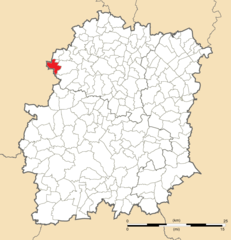
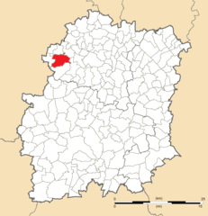
Bonnelles (Bonnelles)
- commune in Yvelines, France
- Country:

- Postal Code: 78830
- Coordinates: 48° 37' 7" N, 2° 1' 40" E


- GPS tracks (wikiloc): [Link]
- Area: 10.84 sq km
- Population: 1927
- Web site: http://www.mairie-bonnelles.fr
- Wikipedia en: wiki(en)
- Wikipedia: wiki(fr)
- Wikidata storage: Wikidata: Q399447
- Wikipedia Commons Category: [Link]
- Freebase ID: [/m/03qg035]
- Freebase ID: [/m/03qg035]
- GeoNames ID: Alt: [6451217]
- GeoNames ID: Alt: [6451217]
- SIREN number: [217800879]
- SIREN number: [217800879]
- BnF ID: [15275904q]
- BnF ID: [15275904q]
- archINFORM location ID: [12624]
- archINFORM location ID: [12624]
- WOEID: [580651]
- WOEID: [580651]
- INSEE municipality code: 78087
- INSEE municipality code: 78087
Shares border with regions:


Angervilliers
- commune in Essonne, France
- Country:

- Postal Code: 91470
- Coordinates: 48° 35' 34" N, 2° 3' 55" E


- GPS tracks (wikiloc): [Link]
- Area: 9.01 sq km
- Population: 1624


Forges-les-Bains
- commune in Essonne, France
- Country:

- Postal Code: 91470
- Coordinates: 48° 37' 41" N, 2° 5' 57" E


- GPS tracks (wikiloc): [Link]
- Area: 14.58 sq km
- Population: 3788
- Web site: [Link]


Pecqueuse
- commune in Essonne, France
- Country:

- Postal Code: 91470
- Coordinates: 48° 38' 47" N, 2° 2' 55" E


- GPS tracks (wikiloc): [Link]
- Area: 7.4 sq km
- Population: 573
- Web site: [Link]


Longvilliers
- commune in Yvelines, France
- Country:

- Postal Code: 78730
- Coordinates: 48° 34' 44" N, 1° 59' 32" E


- GPS tracks (wikiloc): [Link]
- Area: 13.91 sq km
- Population: 498
- Web site: [Link]


Bullion
- commune in Yvelines, France
- Country:

- Postal Code: 78830
- Coordinates: 48° 37' 19" N, 1° 59' 45" E


- GPS tracks (wikiloc): [Link]
- Area: 20.9 sq km
- Population: 1931


Rochefort-en-Yvelines
- commune in Yvelines, France
- Country:

- Postal Code: 78730
- Coordinates: 48° 35' 9" N, 1° 59' 16" E


- GPS tracks (wikiloc): [Link]
- Area: 12.59 sq km
- Population: 885
- Web site: [Link]


Limours
- commune in Essonne, France
- Country:

- Postal Code: 91470
- Coordinates: 48° 38' 44" N, 2° 4' 34" E


- GPS tracks (wikiloc): [Link]
- Area: 14.25 sq km
- Population: 6700
- Web site: [Link]
