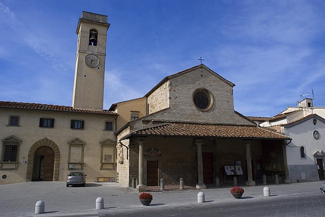
Campi Bisenzio (Campi Bisenzio)
.svg)
- Italian comune
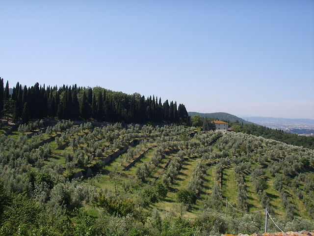
 Hiking in Campi Bisenzio
Campi Bisenzio is a town located in the Tuscany region of Italy, near Florence. While it might not be as well-known for hiking as some other areas of Tuscany, it does offer opportunities for outdoor activities and enjoying the natural beauty of the region.
Hiking Trails and Areas
-
Surrounding Nature Reserves: Campi Bisenzio is close to several nature reserves and parks, such as the Riserva Naturale di Monte Morello and Parco della Pieve. These areas provide scenic trails varying in difficulty, from easy walks to more challenging hikes.
-
Cascine Park: Not far from the town, this park offers a combination of walking paths and green spaces, suitable for a leisurely stroll. It’s an excellent option for families and those looking for a more relaxed hike.
-
Hiking to Prato: Trails connecting Campi Bisenzio to nearby towns such as Prato wind through rural landscapes, olive groves, and vineyards. Walking these routes provides a chance to explore local culture and enjoy the culinary delights of the area.
Tips for Hiking in Campi Bisenzio
-
Best Time to Hike: Spring and early autumn are ideal for hiking in Tuscany, as the weather is usually mild and the landscapes are lush and colorful.
-
Gear: Make sure to wear appropriate hiking shoes, lightweight clothing, and pack sufficient water and snacks.
-
Maps and Guides: Local maps can often be found at tourist information centers, or you can find hiking apps with detailed routes and elevation changes.
-
Respect Nature: As always, follow the Leave No Trace principles, stay on marked trails, and respect wildlife and vegetation.
-
Local Cuisine: Take time to enjoy local Tuscan cuisine after your hike. There are often trattorias and cafes where you can enjoy a meal and relax.
While Campi Bisenzio may not be a major hiking destination, it provides a taste of the beautiful Tuscan landscape and opportunities for enjoyable outdoor experiences.
- Country:

- Postal Code: 50013
- Local Dialing Code: 055
- Licence Plate Code: FI
- Coordinates: 43° 49' 32" N, 11° 8' 0" E


- GPS tracks (wikiloc): [Link]
- AboveSeaLevel: 38 м m
- Area: 29 sq km
- Population: 46696
- Web site: http://www.comune.campi-bisenzio.fi.it/
- Wikipedia en: wiki(en)
- Wikipedia: wiki(it)
- Wikidata storage: Wikidata: Q82636
- Wikipedia Commons Gallery: [Link]
- Wikipedia Commons Category: [Link]
- Freebase ID: [/m/0glcb3]
- GeoNames ID: Alt: [6536820]
- VIAF ID: Alt: [172138382]
- OSM relation ID: [42632]
- archINFORM location ID: [15476]
- MusicBrainz area ID: [1e431fd0-05db-4c56-aefa-259f1eddeb95]
- Quora topic ID: [Campi-Bisenzio]
- UN/LOCODE: [ITCBZ]
- Gran Enciclopèdia Catalana ID: [0013974]
- ISTAT ID: 048006
- Italian cadastre code: B507
Shares border with regions:


Prato
- Italian comune
Hiking in Prato
Prato, located in Tuscany, Italy, offers a variety of hiking opportunities that showcase its beautiful landscapes, rich history, and cultural heritage. Here are some highlights of hiking in and around Prato:...
- Country:
- Postal Code: 59100
- Local Dialing Code: 0574
- Licence Plate Code: PO
- Coordinates: 43° 52' 51" N, 11° 5' 48" E
- GPS tracks (wikiloc): [Link]
- AboveSeaLevel: 65 м m
- Area: 97.35 sq km
- Population: 191749
- Web site: [Link]


Poggio a Caiano
- Italian comune
Hiking in Poggio a Caiano
Poggio a Caiano is a charming town located in Tuscany, Italy, close to Florence, known for its rich history and beautiful landscapes. While it may not be as famous for hiking as some other Tuscan regions, it does offer some lovely trails and opportunities to explore the natural beauty of the area....
- Country:
- Postal Code: 59016
- Local Dialing Code: 055
- Licence Plate Code: PO
- Coordinates: 43° 49' 0" N, 11° 4' 0" E
- GPS tracks (wikiloc): [Link]
- AboveSeaLevel: 45 м m
- Area: 6 sq km
- Population: 10048
- Web site: [Link]

Florence
- Italian city, located in Tuscany
Hiking in Florence
Hiking in Florence offers a unique blend of nature and culture, as the city is surrounded by beautiful landscapes, rolling hills, and picturesque vineyards. Here are some key points and recommendations for hiking in and around Florence:...
- Country:
- Postal Code: 50121–50145; 50100
- Local Dialing Code: 055
- Licence Plate Code: FI
- Coordinates: 43° 46' 17" N, 11° 15' 15" E
- GPS tracks (wikiloc): [Link]
- AboveSeaLevel: 55 м m
- Area: 102 sq km
- Population: 382258
- Web site: [Link]
Calenzano
- Italian comune
Hiking in Calenzano
Calenzano, a charming town located near Florence in Tuscany, Italy, offers a variety of hiking opportunities that showcase the stunning natural beauty of the region. The area is characterized by its rolling hills, picturesque landscapes, and historic sites, making it an excellent destination for outdoor enthusiasts. Here are some key points to consider when hiking in Calenzano:...
- Country:
- Postal Code: 50041
- Local Dialing Code: 055
- Licence Plate Code: FI
- Coordinates: 43° 51' 24" N, 11° 9' 49" E
- GPS tracks (wikiloc): [Link]
- AboveSeaLevel: 108 м m
- Area: 76.97 sq km
- Population: 17914
- Web site: [Link]

Scandicci
- Italian comune
Hiking in Scandicci
Scandicci is a charming town located in the Tuscany region of Italy, near Florence. While it is often associated with its urban areas and proximity to the historical sites of Florence, it also has some attractive hiking opportunities in the surrounding countryside. Here are some highlights and tips for hiking in and around Scandicci:...
- Country:
- Postal Code: 50018
- Local Dialing Code: 055
- Licence Plate Code: FI
- Coordinates: 43° 45' 29" N, 11° 10' 49" E
- GPS tracks (wikiloc): [Link]
- AboveSeaLevel: 47 м m
- Area: 59.7 sq km
- Population: 50645
- Web site: [Link]
Sesto Fiorentino
- Italian comune
Hiking in Sesto Fiorentino
Sesto Fiorentino, located just north of Florence, Italy, offers beautiful hiking opportunities that are perfect for nature lovers and outdoor enthusiasts. Here are some key aspects to consider if you're planning to hike in this area:...
- Country:
- Postal Code: 50019
- Local Dialing Code: 055
- Licence Plate Code: FI
- Coordinates: 43° 50' 0" N, 11° 12' 0" E
- GPS tracks (wikiloc): [Link]
- AboveSeaLevel: 55 м m
- Area: 48.8 sq km
- Population: 49091
- Web site: [Link]

Signa
- Italian comune
Hiking in Signa
Signa is a charming town in Tuscany, Italy, located near Florence. While it may not be the first destination that comes to mind for hiking, there are several scenic options in and around the area that offer beautiful landscapes and a taste of the Tuscan countryside....
- Country:
- Postal Code: 50058
- Local Dialing Code: 055
- Licence Plate Code: FI
- Coordinates: 43° 47' 39" N, 11° 6' 13" E
- GPS tracks (wikiloc): [Link]
- AboveSeaLevel: 46 м m
- Area: 18.81 sq km
- Population: 18901
- Web site: [Link]