Chélieu (Chélieu)

- commune in Isère, France
 Hiking in Chélieu
Chélieu, located in the Isère department of the Auvergne-Rhône-Alpes region in France, offers beautiful landscapes and opportunities for hiking enthusiasts. The area is characterized by its stunning mountainous terrain, with the Chartreuse Mountains nearby providing a range of trails suitable for different skill levels.
When hiking in Chélieu, here are a few points to consider:
-
Trails: There are several marked hiking trails in and around Chélieu, ranging from easy walks to more challenging hikes. Popular routes may include paths that lead through forests, alpine meadows, and offer panoramic views of the surrounding mountains and valleys.
-
Preparation: As with any hiking venture, it’s important to come prepared. Wear appropriate footwear, carry enough water, and pack snacks. Always check the weather forecast before heading out, as conditions can change rapidly in mountainous areas.
-
Local Flora and Fauna: The region is rich in biodiversity. Keep an eye out for local wildlife and unique flora along the trails, especially during spring and summer when wildflowers bloom.
-
Cultural Heritage: While hiking, you may encounter quaint villages, historical sites, and local culture. Take the time to explore the village of Chélieu itself, as it may have interesting architecture and local specialties to enjoy.
-
Guided Tours: If you are new to the area or prefer to have a knowledgeable guide, consider joining a guided hiking tour. This can enhance your experience with local insights about the terrain and environment.
-
Safety: Always inform someone about your hiking plans and estimated return time. If you're hiking during less busy seasons, consider more populated trails to stay safe and find assistance if needed.
-
Leave No Trace: Practice Leave No Trace principles to minimize your impact on the environment. Pack out what you pack in and respect the natural surroundings.
Before you plan your hike, check local resources for trail maps and updates on trail conditions. Enjoy your time in Chélieu, and happy hiking!
- Country:

- Postal Code: 38730
- Coordinates: 45° 30' 44" N, 5° 28' 33" E


- GPS tracks (wikiloc): [Link]
- AboveSeaLevel: 607 м m
- Area: 10.13 sq km
- Population: 674
- Web site: http://www.chelieu.fr
- Wikipedia en: wiki(en)
- Wikipedia: wiki(fr)
- Wikidata storage: Wikidata: Q939805
- Wikipedia Commons Category: [Link]
- Freebase ID: [/m/03nvgth]
- GeoNames ID: Alt: [6448760]
- SIREN number: [213800980]
- INSEE municipality code: 38098
Shares border with regions:


Doissin
- commune in Isère, France
Hiking in Doissin
Doissin, located in the Auvergne-Rhône-Alpes region of France, is a beautiful spot for hiking enthusiasts. The area is characterized by its picturesque landscapes, including rolling hills, forests, and scenic viewpoints....
- Country:
- Postal Code: 38730
- Coordinates: 45° 29' 59" N, 5° 25' 25" E
- GPS tracks (wikiloc): [Link]
- Area: 8.45 sq km
- Population: 891
- Web site: [Link]


Virieu
- commune in Isère, France
Hiking in Virieu
Virieu is a charming commune located in the Auvergne-Rhône-Alpes region of France. It's surrounded by picturesque landscapes, making it an excellent destination for hiking enthusiasts. Here are some key aspects of hiking in Virieu:...
- Country:
- Postal Code: 38730
- Coordinates: 45° 29' 8" N, 5° 28' 32" E
- GPS tracks (wikiloc): [Link]
- Area: 11.38 sq km
- Population: 1110
- Web site: [Link]


Valencogne
- commune in Isère, France
Hiking in Valencogne
Valencogne is a lesser-known but beautiful destination for hiking, located in the French Alps. Here are some highlights and tips for hiking in this area:...
- Country:
- Postal Code: 38730
- Coordinates: 45° 29' 57" N, 5° 32' 24" E
- GPS tracks (wikiloc): [Link]
- Area: 7.55 sq km
- Population: 662
- Web site: [Link]

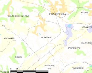
Le Passage
- commune in Isère, France
Hiking in Le Passage
Le Passage is a small village located in the Isère department of the Auvergne-Rhône-Alpes region in southeastern France. While it may not be as widely recognized as some larger hiking destinations, the surrounding Isère region offers a wealth of hiking opportunities, particularly in the nearby Vercors and Chartreuse mountain ranges....
- Country:
- Postal Code: 38490
- Coordinates: 45° 31' 58" N, 5° 30' 43" E
- GPS tracks (wikiloc): [Link]
- Area: 6.68 sq km
- Population: 783
- Web site: [Link]


Chassignieu
- commune in Isère, France
Hiking in Chassignieu
Chassignieu is a small commune located in the Auvergne-Rhône-Alpes region of France, which offers scenic trails and beautiful natural surroundings, making it an appealing destination for hiking enthusiasts. Here are some key points to consider if you're planning to hike in and around Chassignieu:...
- Country:
- Postal Code: 38730
- Coordinates: 45° 30' 1" N, 5° 30' 16" E
- GPS tracks (wikiloc): [Link]
- Area: 5.17 sq km
- Population: 221


Panissage
- commune in Isère, France
Hiking in Panissage
I'm sorry, but it seems like there isn't a well-known hiking destination specifically called "Panissage." It's possible that it might be a lesser-known area, a local spot, or perhaps a misspelling of another location....
- Country:
- Postal Code: 38730
- Coordinates: 45° 29' 39" N, 5° 27' 47" E
- GPS tracks (wikiloc): [Link]
- Area: 4.88 sq km
- Population: 448


Montagnieu
- commune in Isère, France
Hiking in Montagnieu
Montagnieu, located in the department of Isère in the Auvergne-Rhône-Alpes region of France, offers a variety of hiking options that showcase the natural beauty of the surrounding landscapes. Here are some key points about hiking in this area:...
- Country:
- Postal Code: 38110
- Coordinates: 45° 31' 27" N, 5° 27' 9" E
- GPS tracks (wikiloc): [Link]
- Area: 8.83 sq km
- Population: 1023