La Réole (La Réole)

- commune in Gironde, France
- Country:

- Postal Code: 33190
- Coordinates: 44° 34' 52" N, 0° 2' 28" E


- GPS tracks (wikiloc): [Link]
- Area: 12.53 sq km
- Population: 4173
- Web site: http://www.lareole.fr
- Wikipedia en: wiki(en)
- Wikipedia: wiki(fr)
- Wikidata storage: Wikidata: Q263456
- Wikipedia Commons Category: [Link]
- Freebase ID: [/m/08x5dc]
- GeoNames ID: Alt: [3006979]
- SIREN number: [213303522]
- BnF ID: [15256402g]
- VIAF ID: Alt: [126682654]
- GND ID: Alt: [4304456-6]
- Library of Congress authority ID: Alt: [n81120523]
- INSEE municipality code: 33352
Shares border with regions:


Saint-Hilaire-de-la-Noaille
- commune in Gironde, France
- Country:
- Postal Code: 33190
- Coordinates: 44° 36' 4" N, 0° 0' 6" E
- GPS tracks (wikiloc): [Link]
- Area: 11.45 sq km
- Population: 382


Bagas
- commune in Gironde, France
- Country:
- Postal Code: 33190
- Coordinates: 44° 37' 30" N, 0° 3' 21" E
- GPS tracks (wikiloc): [Link]
- Area: 3.63 sq km
- Population: 292

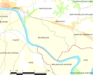
Bourdelles
- commune in Gironde, France
- Country:
- Postal Code: 33190
- Coordinates: 44° 33' 12" N, 0° 0' 1" E
- GPS tracks (wikiloc): [Link]
- Area: 7.06 sq km
- Population: 98


Floudès
- commune in Gironde, France
- Country:
- Postal Code: 33190
- Coordinates: 44° 34' 22" N, 0° 4' 3" E
- GPS tracks (wikiloc): [Link]
- Area: 3.7 sq km
- Population: 98


Saint-Sève
- commune in Gironde, France
- Country:
- Postal Code: 33190
- Coordinates: 44° 36' 35" N, 0° 1' 45" E
- GPS tracks (wikiloc): [Link]
- Area: 4.8 sq km
- Population: 245


Fontet
- commune in Gironde, France
- Country:
- Postal Code: 33190
- Coordinates: 44° 33' 32" N, 0° 1' 51" E
- GPS tracks (wikiloc): [Link]
- Area: 7.67 sq km
- Population: 808
- Web site: [Link]


Gironde-sur-Dropt
- commune in Gironde, France
- Country:
- Postal Code: 33190
- Coordinates: 44° 35' 1" N, 0° 5' 22" E
- GPS tracks (wikiloc): [Link]
- AboveSeaLevel: 20 м m
- Area: 8.84 sq km
- Population: 1224
- Web site: [Link]


Les Esseintes
- commune in Gironde, France
- Country:
- Postal Code: 33190
- Coordinates: 44° 36' 35" N, 0° 4' 3" E
- GPS tracks (wikiloc): [Link]
- Area: 5.1 sq km
- Population: 240


Montagoudin
- commune in Gironde, France
- Country:
- Postal Code: 33190
- Coordinates: 44° 34' 40" N, 0° 0' 1" E
- GPS tracks (wikiloc): [Link]
- AboveSeaLevel: 150 м m
- Area: 3.34 sq km
- Population: 186