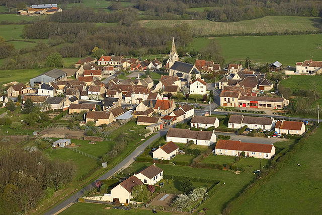
Martizay (Martizay)

- commune in Indre, France
- Country:

- Postal Code: 36220
- Coordinates: 46° 48' 26" N, 1° 2' 35" E


- GPS tracks (wikiloc): [Link]
- Area: 39 sq km
- Population: 973
- Web site: http://www.martizay.fr
- Wikipedia en: wiki(en)
- Wikipedia: wiki(fr)
- Wikidata storage: Wikidata: Q1137605
- Wikipedia Commons Category: [Link]
- Freebase ID: [/m/03nvbgm]
- GeoNames ID: Alt: [2995360]
- SIREN number: [213601131]
- BnF ID: [15257417r]
- VIAF ID: Alt: [235148574377824430001]
- GND ID: Alt: [4115030-2]
- PACTOLS thesaurus ID: [pcrtJpPND560hX]
- SUDOC authorities ID: [085947636]
- Digital Atlas of the Roman Empire ID: [16977]
- INSEE municipality code: 36113
Shares border with regions:


Azay-le-Ferron
- commune in Indre, France
- Country:
- Postal Code: 36290
- Coordinates: 46° 51' 6" N, 1° 4' 10" E
- GPS tracks (wikiloc): [Link]
- Area: 60.95 sq km
- Population: 861


Saint-Michel-en-Brenne
- commune in Indre, France
- Country:
- Postal Code: 36290
- Coordinates: 46° 48' 22" N, 1° 9' 29" E
- GPS tracks (wikiloc): [Link]
- Area: 49.15 sq km
- Population: 324


Lingé
- commune in Indre, France
- Country:
- Postal Code: 36220
- Coordinates: 46° 45' 18" N, 1° 5' 2" E
- GPS tracks (wikiloc): [Link]
- Area: 32.66 sq km
- Population: 232


Bossay-sur-Claise
- commune in Indre-et-Loire, France
- Country:
- Postal Code: 37290
- Coordinates: 46° 49' 56" N, 0° 57' 44" E
- GPS tracks (wikiloc): [Link]
- Area: 65.56 sq km
- Population: 769
- Web site: [Link]

Lureuil
- commune in Indre, France
- Country:
- Postal Code: 36220
- Coordinates: 46° 44' 38" N, 1° 2' 33" E
- GPS tracks (wikiloc): [Link]
- Area: 22.04 sq km
- Population: 266