Peschiera Borromeo (Peschiera Borromeo)
.svg)
- Italian comune
 Hiking in Peschiera Borromeo
Peschiera Borromeo, located just southeast of Milan in Italy, is not primarily known for its extensive hiking trails compared to larger natural parks or mountainous regions. However, the area does offer some opportunities for leisurely walks and hikes, particularly in its green spaces and along the nearby waterways.
Local Parks and Nature Areas
-
Parco dei Germani: This park features well-marked trails and is great for short hikes or nature walks. The area is home to various bird species, making it ideal for birdwatching as well.
-
Naviglio Pavese: The pathways along this historic canal provide a flat, scenic route for walking or biking. You can enjoy views of the water and surrounding countryside while experiencing a piece of the region's history.
-
Montestella: A bit further away is Montestella Park, located in Milan, which offers a more elevated hiking experience with panoramic views of the city and surrounding areas.
Tips for Hiking in Peschiera Borromeo
- Stay Hydrated: Always carry enough water, especially during warmer months.
- Footwear: Wear comfortable hiking shoes, as some paths might be uneven.
- Plan Your Route: Make sure to have a map or use a hiking app to navigate any trails.
- Check Weather Conditions: Always check the local weather before heading out, as conditions can change quickly.
Nearby Hiking Opportunities
If you’re willing to travel a bit farther from Peschiera Borromeo, you can access more robust hiking areas:
- Parco della Portofino: Located about an hour away, it features trails with stunning views of the Ligurian coast.
- Val Grande National Park: A bit further north, this park offers more challenging hikes through mountainous terrain.
In summary, while Peschiera Borromeo itself may not be a hiking destination, it offers nice options for walks in nature, and you can easily access more challenging trails within a short drive.
- Country:

- Postal Code: 20068
- Local Dialing Code: 02
- Licence Plate Code: MI
- Coordinates: 45° 26' 0" N, 9° 19' 0" E


- GPS tracks (wikiloc): [Link]
- AboveSeaLevel: 107 м m
- Area: 23.22 sq km
- Population: 23515
- Web site: http://www.comune.peschieraborromeo.it
- Wikipedia en: wiki(en)
- Wikipedia: wiki(it)
- Wikidata storage: Wikidata: Q43028
- Wikipedia Commons Category: [Link]
- Freebase ID: [/m/0gj72c]
- GeoNames ID: Alt: [3171153]
- VIAF ID: Alt: [242780733]
- OSM relation ID: [45015]
- archINFORM location ID: [16835]
- MusicBrainz area ID: [a4ef6d7d-f0dc-42c0-b8c9-5c2e06641a89]
- Quora topic ID: [Peschiera-Borromeo]
- TGN ID: [7051883]
- UN/LOCODE: [ITPSB]
- ISTAT ID: 015171
- Italian cadastre code: G488
Shares border with regions:


San Donato Milanese
- Italian comune
Hiking in San Donato Milanese
San Donato Milanese, located just south of Milan, is primarily known as a residential and business district rather than a hiking destination. However, there are various options for outdoor lovers in and around the area....
- Country:
- Postal Code: 20097
- Local Dialing Code: 02
- Licence Plate Code: MI
- Coordinates: 45° 25' 0" N, 9° 16' 0" E
- GPS tracks (wikiloc): [Link]
- AboveSeaLevel: 102 м m
- Area: 12.88 sq km
- Population: 32416
- Web site: [Link]


Pantigliate
- comune of Italy
Hiking in Pantigliate
Pantigliate, located in the Metropolitan City of Milan in Italy, is not particularly known for extensive hiking trails like other more mountainous regions of Italy. However, its proximity to natural parks and green areas makes it a good base for outdoor activities, including hiking....
- Country:
- Postal Code: 20090
- Local Dialing Code: 02
- Licence Plate Code: MI
- Coordinates: 45° 26' 7" N, 9° 21' 8" E
- GPS tracks (wikiloc): [Link]
- AboveSeaLevel: 102 м m
- Area: 5.69 sq km
- Population: 6113
- Web site: [Link]
Mediglia
- Italian comune
Hiking in Mediglia
Mediglia is a small town located in the Lombardy region of Italy, near Milan. While it may not be as famous for hiking as the nearby mountainous areas like the Italian Alps or the Appennines, there are still opportunities for outdoor walks and exploration in and around Mediglia....
- Country:
- Postal Code: 20060
- Local Dialing Code: 02
- Licence Plate Code: MI
- Coordinates: 45° 24' 0" N, 9° 20' 0" E
- GPS tracks (wikiloc): [Link]
- AboveSeaLevel: 95 м m
- Area: 21.96 sq km
- Population: 12198
- Web site: [Link]


Rodano
- Italian comune
Hiking in Rodano
Rodano is a small town located in the Lombardy region of Italy, near Milan. While the area itself may not be known as a major hiking destination, it is conveniently located near several natural parks and hiking trails that can offer beautiful outdoor experiences....
- Country:
- Postal Code: 20090
- Local Dialing Code: 02
- Licence Plate Code: MI
- Coordinates: 45° 29' 0" N, 9° 21' 0" E
- GPS tracks (wikiloc): [Link]
- AboveSeaLevel: 120 м m
- Area: 13.07 sq km
- Population: 4651
- Web site: [Link]
Pioltello
- Italian comune
Hiking in Pioltello
Pioltello, a town located in the Lombardy region of Italy, is primarily an urban area and doesn’t have extensive hiking trails directly within its boundaries. However, it is situated near various natural reserves and parks in the surrounding areas, making it a good base for exploring some beautiful hiking trails nearby....
- Country:
- Postal Code: 20096
- Local Dialing Code: 02
- Licence Plate Code: MI
- Coordinates: 45° 30' 0" N, 9° 20' 0" E
- GPS tracks (wikiloc): [Link]
- AboveSeaLevel: 122 м m
- Area: 13.09 sq km
- Population: 37045
- Web site: [Link]


Segrate
- Italian comune
Hiking in Segrate
Segrate, located in the Lombardy region of Italy, is part of the metropolitan area of Milan. While it might not be as famous for hiking as some other regions in Italy, it does offer some opportunities for outdoor enthusiasts. Here are some things to consider if you're looking to hike in and around Segrate:...
- Country:
- Postal Code: 20090
- Local Dialing Code: 02
- Licence Plate Code: MI
- Coordinates: 45° 29' 24" N, 9° 17' 43" E
- GPS tracks (wikiloc): [Link]
- AboveSeaLevel: 115 м m
- Area: 17.49 sq km
- Population: 35234
- Web site: [Link]
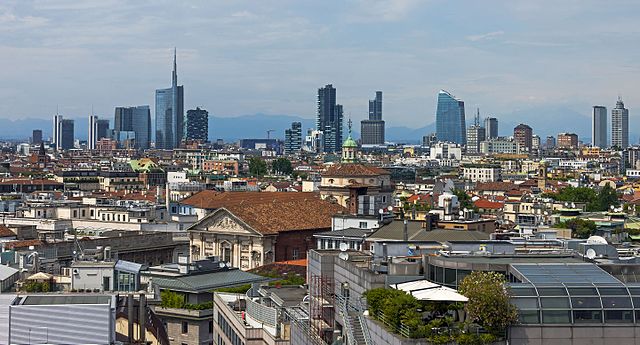

Milan
- second-largest city in Italy
Hiking in Milan
Hiking in and around Milan offers a unique blend of urban and natural experiences. While Milan itself is a bustling metropolitan area, it is also well-positioned near several excellent hiking spots in the surrounding regions. Here are some noteworthy areas and tips for hiking near Milan:...
- Country:
- Postal Code: 20162; 20161; 20159; 20158; 20157; 20156; 20155; 20154; 20153; 20152; 20151; 20149; 20148; 20147; 20146; 20145; 20144; 20143; 20142; 20141; 20139; 20138; 20137; 20136; 20135; 20134; 20133; 20132; 20131; 20129; 20128; 20127; 20126; 20125; 20124; 20123; 20122; 20121
- Local Dialing Code: 02
- Licence Plate Code: MI
- Coordinates: 45° 27' 51" N, 9° 11' 25" E
- GPS tracks (wikiloc): [Link]
- AboveSeaLevel: 120 м m
- Area: 181.67 sq km
- Population: 1351562
- Web site: [Link]