Reilhaguet (Reilhaguet)

- commune in Lot, France
- Country:

- Postal Code: 46350
- Coordinates: 44° 46' 13" N, 1° 30' 16" E


- GPS tracks (wikiloc): [Link]
- Area: 15.96 sq km
- Population: 131
- Wikipedia en: wiki(en)
- Wikipedia: wiki(fr)
- Wikidata storage: Wikidata: Q1321383
- Wikipedia Commons Category: [Link]
- Freebase ID: [/m/03nwny8]
- GeoNames ID: Alt: [6434869]
- SIREN number: [214602369]
- BnF ID: [15260977h]
- VIAF ID: Alt: [126420107]
- INSEE municipality code: 46236
Shares border with regions:

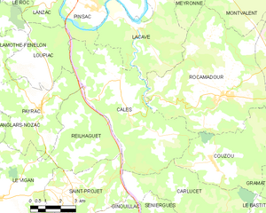
Calès
- commune in Lot, France
- Country:
- Postal Code: 46350
- Coordinates: 44° 48' 45" N, 1° 32' 17" E
- GPS tracks (wikiloc): [Link]
- Area: 34.23 sq km
- Population: 164
- Web site: [Link]

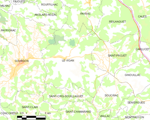
Le Vigan
- commune in Lot, France
- Country:
- Postal Code: 46300
- Coordinates: 44° 44' 30" N, 1° 26' 20" E
- GPS tracks (wikiloc): [Link]
- Area: 34.4 sq km
- Population: 1568


Saint-Projet
- commune in Lot, France
- Country:
- Postal Code: 46300
- Coordinates: 44° 44' 41" N, 1° 29' 26" E
- GPS tracks (wikiloc): [Link]
- AboveSeaLevel: 351 м m
- Area: 15.83 sq km
- Population: 349


Payrac
- commune in Lot, France
- Country:
- Postal Code: 46350
- Coordinates: 44° 47' 47" N, 1° 28' 19" E
- GPS tracks (wikiloc): [Link]
- Area: 19.5 sq km
- Population: 631