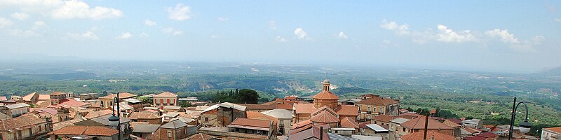
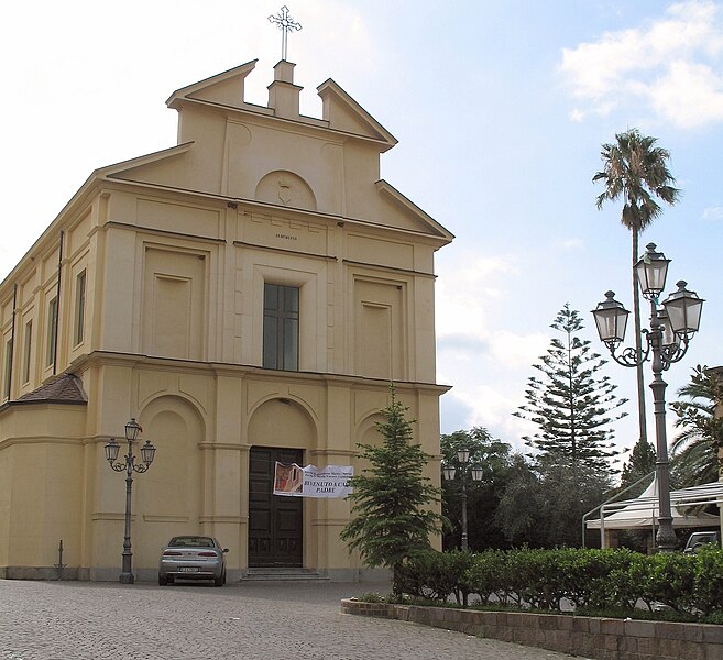
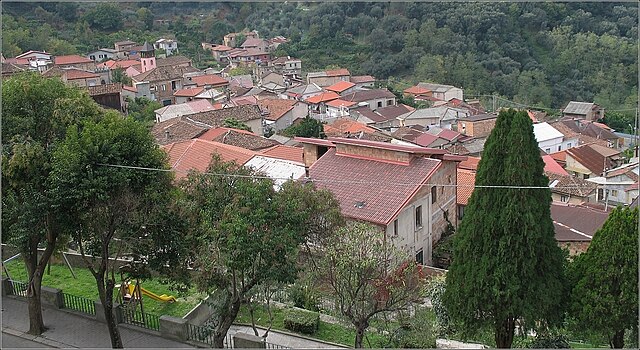
San Pietro di Caridà (San Pietro di Caridà)
.svg)
- Italian comune
 Hiking in San Pietro di Caridà
San Pietro di Caridà is a small town located in the Calabria region of southern Italy. Known for its natural beauty and mountainous terrain, it offers a variety of hiking opportunities that allow outdoor enthusiasts to explore its picturesque landscape, rich biodiversity, and the unique culture of the region.
Hiking Opportunities:
-
Scenic Trails: The surrounding area features numerous trails that wind through lush forests, olive groves, and rural landscapes. Many of these trails offer stunning views of the Aspromonte National Park and the Tyrrhenian Sea.
-
Aspromonte National Park: Just a short drive away, this national park is a highlight for hikers, with a range of trails suitable for all skill levels. The park is home to dramatic cliffs, waterfalls, and diverse wildlife, making it an excellent spot for both hiking and nature observation.
-
Cultural Hikes: Many trails lead to traditional villages and historical sites, allowing hikers to experience the local culture and heritage. Stops at small churches or ancient ruins can add a cultural element to your hike.
-
Difficulty Levels: Hikes can range from easy, family-friendly paths to more challenging routes that require good fitness and experience. It’s advisable to choose a trail that matches your skill level and to prepare accordingly.
Preparation Tips:
- Footwear: Wear good quality hiking boots with ankle support to navigate varying terrains comfortably.
- Weather Considerations: Check the weather conditions before heading out, as they can change rapidly in mountainous regions.
- Water and Snacks: Carry enough water and snacks, especially for longer hikes, as facilities might be limited on the trails.
- Maps and Navigation: Bring a map or a GPS device, especially if you’re exploring less-marked trails.
Local Highlights:
- Flora and Fauna: The region is renowned for its biodiversity, so keep an eye out for unique plants and wildlife during your hikes.
- Local Cuisine: After a day of hiking, enjoy the local cuisine, which features fresh ingredients from the region. Be sure to try local specialties, such as 'nduja and various pasta dishes.
Final Note:
Always respect nature and local regulations while hiking. Leave no trace, stay on marked trails, and be aware of any wildlife in the area. Whether you’re looking for a leisurely stroll or an adventure through rugged terrains, San Pietro di Caridà and its surroundings provide a fantastic backdrop for hiking experiences. Enjoy your adventure!
- Country:

- Postal Code: 89020
- Local Dialing Code: 0966
- Licence Plate Code: RC
- Coordinates: 38° 31' 29" N, 16° 8' 10" E


- GPS tracks (wikiloc): [Link]
- AboveSeaLevel: 325 м m
- Area: 48.08 sq km
- Population: 1143
- Web site: http://sanpietrodicarida.asmenet.it/
- Wikipedia en: wiki(en)
- Wikipedia: wiki(it)
- Wikidata storage: Wikidata: Q54651
- Wikipedia Commons Category: [Link]
- Freebase ID: [/m/0gnz56]
- GeoNames ID: Alt: [6543638]
- OSM relation ID: [39640]
- ISTAT ID: 080075
- Italian cadastre code: I102
Shares border with regions:


Galatro
- Italian comune
Hiking in Galatro
Galatro, a small town in the Calabria region of southern Italy, is known for its picturesque landscapes, rolling hills, and natural beauty. The area offers various hiking opportunities that allow you to immerse yourself in the stunning scenery of the Aspromonte National Park and the surrounding landscapes....
- Country:
- Postal Code: 89054
- Local Dialing Code: 0966
- Licence Plate Code: RC
- Coordinates: 38° 28' 0" N, 16° 7' 0" E
- GPS tracks (wikiloc): [Link]
- AboveSeaLevel: 158 м m
- Area: 51.34 sq km
- Population: 1671
- Web site: [Link]

Laureana di Borrello
- Italian comune
Hiking in Laureana di Borrello
Laureana di Borrello is a charming town located in the Calabria region of southern Italy. It offers a rich array of hiking opportunities, thanks to its beautiful landscapes, rolling hills, and proximity to the Aspromonte National Park. Here’s what you can expect when hiking in this area:...
- Country:
- Postal Code: 89023
- Local Dialing Code: 0966
- Licence Plate Code: RC
- Coordinates: 38° 29' 31" N, 16° 4' 52" E
- GPS tracks (wikiloc): [Link]
- AboveSeaLevel: 273 м m
- Area: 35.69 sq km
- Population: 5080
- Web site: [Link]

Serrata, Italy
- Italian comune
Hiking in Serrata, Italy
Serrata, located in the Calabria region of southern Italy, is a lesser-known but beautiful area for hiking enthusiasts. Known for its rugged landscapes and diverse natural beauty, Calabria offers a unique experience for hikers looking to explore Italy's natural scenery away from the more touristy spots....
- Country:
- Postal Code: 89020
- Local Dialing Code: 0966
- Licence Plate Code: RC
- Coordinates: 38° 30' 45" N, 16° 6' 0" E
- GPS tracks (wikiloc): [Link]
- AboveSeaLevel: 283 м m
- Area: 22.06 sq km
- Population: 821
- Web site: [Link]


Acquaro
- Italian comune
Hiking in Acquaro
Acquaro, located in the Calabria region of southern Italy, is a picturesque area known for its natural beauty and charming landscapes. While it may not be as well-known as some other hiking destinations in Italy, it offers plenty of opportunities for outdoor enthusiasts....
- Country:
- Postal Code: 89832
- Local Dialing Code: 0963
- Licence Plate Code: VV
- Coordinates: 38° 33' 21" N, 16° 11' 17" E
- GPS tracks (wikiloc): [Link]
- AboveSeaLevel: 262 м m
- Area: 25.25 sq km
- Population: 2331
- Web site: [Link]

Dinami
- Italian comune
Hiking in Dinami
It seems there may be a misunderstanding, as "Dinami" might not refer to a widely recognized hiking destination. If you could provide additional context or correct the location name, I'd be happy to help!...
- Country:
- Postal Code: 89833
- Local Dialing Code: 0966
- Licence Plate Code: VV
- Coordinates: 38° 32' 0" N, 16° 9' 0" E
- GPS tracks (wikiloc): [Link]
- AboveSeaLevel: 260 м m
- Area: 44.45 sq km
- Population: 2062
- Web site: [Link]


Fabrizia
- Italian comune
Hiking in Fabrizia
Fabrizia is located in the Calabria region of southern Italy and is known for its stunning natural beauty, characterized by mountains, forests, and gorgeous landscapes. It is a great area for hiking enthusiasts, offering a variety of trails that cater to different skill levels....
- Country:
- Postal Code: 89823
- Local Dialing Code: 0963
- Licence Plate Code: VV
- Coordinates: 38° 29' 17" N, 16° 18' 6" E
- GPS tracks (wikiloc): [Link]
- AboveSeaLevel: 947 м m
- Area: 40 sq km
- Population: 2162
- Web site: [Link]