Нарн-им-Махланде (Naarn im Machlande, Naarn im Machlande)
 Hiking in Нарн-им-Махланде
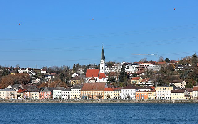
Naarn im Machlande, located in Austria, is not as widely known as some of the country's larger hiking destinations, but it offers a charming experience for those looking to explore the scenic beauty of the region. The area is characterized by its gentle rolling hills, lush fields, and picturesque landscapes, making it suitable for amateur and experienced hikers alike.
Hiking Opportunities:
-
Nature Trails: There are various well-marked trails around Naarn im Machlande that guide hikers through the beautiful rural landscapes. These trails are often suitable for families and can be enjoyed year-round.
-
Scenic Routes: The surrounding countryside offers a mix of agricultural areas, woodlands, and small bodies of water, providing plenty of opportunities for photography and nature observation.
-
Local Flora and Fauna: Hikers can enjoy the diverse ecosystems along the trails, observing local wildlife and plant species native to the area.
Tips for Hiking in Naarn im Machlande:
- Maps and Navigation: It's a good idea to have a map or a hiking app to guide you along the trails, as some areas may not be well signposted.
- Weather Preparedness: Check the weather forecast before you head out, as conditions can change quickly in the countryside.
- Appropriate Gear: Wear comfortable hiking shoes and dress in layers, as temperatures can vary throughout the day.
- Stay Hydrated: Bring plenty of water, especially on warmer days, as there may not be water sources along the routes.
- Respect Nature: Follow Leave No Trace principles to protect the local environment.
Nearby Attractions:
Consider extending your trip to explore nearby towns, local farms, or cultural sites to enrich your hiking experience.
If you’re looking for a peaceful hiking experience away from the more crowded trails in Austria, Naarn im Machlande might just be the perfect spot for you!
- Страна:

- Почтовый код: 4331
- Телефонный код: 07262
- Код автомобильного номера: PE
- Координаты: 48° 13' 36" N, 14° 36' 32" E


- GPS треки (wikiloc): [Ссылка]
- Высота над уровнем моря: 245 м m
- Площадь: 35.17 кв.км
- Население: 3690
- Веб сайт: http://www.naarn.at/
- Википедия русская: wiki(ru)
- Википедия английская: wiki(en)
- Википедия национальная: wiki(de)
- Хранилище Wikidata: Wikidata: Q668650
- Катеория в википедии: [Ссылка]
- код Freebase: [/m/03gv7gp]
- код GeoNames: Альт: [7872070]
- код VIAF: Альт: [246943814]
- код GND: Альт: [4428057-9]
- код австрийского муниципалитета: [41114]
Граничит с регионами:

Перг
Hiking in Перг
Hiking in Perg, Austria, is a delightful experience, offering a variety of trails that cater to different skill levels and interests. The region is characterized by its beautiful landscapes, including rolling hills, forests, and scenic vistas overlooking the Danube River....
- Страна:
- Почтовый код: 4320
- Телефонный код: 07262
- Код автомобильного номера: PE
- Координаты: 48° 15' 1" N, 14° 38' 1" E
- GPS треки (wikiloc): [Ссылка]
- Высота над уровнем моря: 250 м m
- Площадь: 26.44 кв.км
- Население: 8388
- Веб сайт: [Ссылка]
Маутхаузен
Hiking in Маутхаузен
Mauthausen, located in Austria, is best known for its historical significance due to the former concentration camp situated nearby. However, the region also offers beautiful hiking opportunities, particularly for those looking to explore the scenic landscapes of Upper Austria....
- Страна:
- Почтовый код: 4310
- Телефонный код: 07238
- Код автомобильного номера: PE
- Координаты: 48° 14' 31" N, 14° 31' 1" E
- GPS треки (wikiloc): [Ссылка]
- Высота над уровнем моря: 265 м m
- Площадь: 14.03 кв.км
- Население: 4936
- Веб сайт: [Ссылка]

Санкт-Панталеон-Эрла
Hiking in Санкт-Панталеон-Эрла
Sankt Pantaleon-Erla is a picturesque area in Austria known for its beautiful landscapes and outdoor activities, including hiking. Nestled amidst rolling hills and lush greenery, it offers various trails that cater to hikers of different skill levels....
- Страна:
- Почтовый код: 4303
- Телефонный код: 07435
- Код автомобильного номера: AM
- Координаты: 48° 11' 57" N, 14° 34' 17" E
- GPS треки (wikiloc): [Ссылка]
- Высота над уровнем моря: 242 м m
- Площадь: 28.38 кв.км
- Население: 2587
- Веб сайт: [Ссылка]

Миттеркирхен
Hiking in Миттеркирхен
Mitterkirchen im Machland, located in the Upper Austria region, is a beautiful area for hiking enthusiasts. The surrounding landscape features charming countryside, lush green fields, and rolling hills, making it an ideal spot for various hiking trails suitable for all levels....
- Страна:
- Почтовый код: 4343
- Телефонный код: 07269
- Код автомобильного номера: PE
- Координаты: 48° 11' 1" N, 14° 42' 34" E
- GPS треки (wikiloc): [Ссылка]
- Высота над уровнем моря: 235 м m
- Площадь: 28.93 кв.км
- Население: 1718
- Веб сайт: [Ссылка]
Штренгберг
Hiking in Штренгберг
Strengberg, located in Upper Austria, offers a variety of hiking opportunities for outdoor enthusiasts. The scenic landscape is characterized by rolling hills, forests, and beautiful views of the surrounding countryside. Here are some key points to consider for hiking in Strengberg:...
- Страна:
- Почтовый код: 3314
- Телефонный код: 07432
- Код автомобильного номера: AM
- Координаты: 48° 8' 36" N, 14° 39' 2" E
- GPS треки (wikiloc): [Ссылка]
- Высота над уровнем моря: 358 м m
- Площадь: 36.81 кв.км
- Население: 2055
- Веб сайт: [Ссылка]


Швертберг
Hiking in Швертберг
Schwertberg, located in Upper Austria, is a great destination for hiking enthusiasts. The region is characterized by picturesque landscapes, lush forests, and rolling hills, making it suitable for various levels of hikers....
- Страна:
- Почтовый код: 4311
- Телефонный код: 07262
- Код автомобильного номера: PE
- Координаты: 48° 16' 18" N, 14° 35' 0" E
- GPS треки (wikiloc): [Ссылка]
- Высота над уровнем моря: 268 м m
- Площадь: 18.78 кв.км
- Население: 5365
- Веб сайт: [Ссылка]