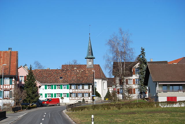
Вельди (Wäldi, Wäldi)

 Hiking in Вельди
Wäldli (often spelled Wäldi) is a beautiful hiking destination that offers a variety of trails suited to different skill levels. Nestled in the surroundings of natural landscapes, Wäldi usually features lush forests, calming streams, and scenic viewpoints, making it an ideal spot for both novice and experienced hikers.
Hiking Trails
-
Beginner Trails: These are typically well-marked paths that are relatively flat and easy to navigate. Perfect for families or those looking for a leisurely stroll amidst nature.
-
Intermediate Trails: Slightly more challenging, these trails may feature moderate elevation changes and rocky terrains. Hikers can enjoy beautiful vistas and get a bit of a workout.
-
Advanced Trails: For seasoned hikers, there are more rugged paths with steep ascents and potential scrambles. These trails often lead to panoramic viewpoints or hidden gems, like waterfalls or secluded lakes.
Tips for Hiking in Wäldi
- Check the Weather: Always look at the forecast before heading out. Weather can change rapidly in mountainous areas.
- Wear Appropriate Gear: Comfortable hiking boots, layered clothing, and a good backpack can make your hike more enjoyable.
- Stay Hydrated: Bring enough water, especially on warmer days, as some trails may not have convenient water sources.
- Follow Trail Markers: Stick to marked trails to protect the environment and ensure your safety.
- Respect Wildlife: If you encounter animals, observe from a distance and do not feed them.
Seasonal Considerations
Each season offers a unique experience in Wäldi. In autumn, you’ll see beautiful fall foliage, while summer provides lush greenery. Winter hikes can be magical with snow-covered landscapes, but be sure to check if snowshoes or crampons are necessary.
Safety Precautions
- Always inform someone about your hiking plans and expected return time.
- Carry a first-aid kit, a map, or a GPS device.
- Be cautious of the terrain and know your limits.
Conclusion
Hiking in Wäldi has something for everyone, from scenic and easy trails to challenging hikes that provide a sense of adventure. Whatever your skill level, it’s a wonderful way to connect with nature and enjoy the great outdoors. Happy hiking!
- Страна:

- Почтовый код: 8564
- Телефонный код: 071
- Код автомобильного номера: TG
- Координаты: 47° 37' 28" N, 9° 4' 57" E


- GPS треки (wikiloc): [Ссылка]
- Высота над уровнем моря: 553 м m
- Площадь: 12.3 кв.км
- Население: 1048
- Веб сайт: http://www.waeldi.ch
- Википедия русская: wiki(ru)
- Википедия английская: wiki(en)
- Википедия национальная: wiki(de)
- Хранилище Wikidata: Wikidata: Q65991
- Катеория в википедии: [Ссылка]
- код Freebase: [/m/0g3s7l]
- код GeoNames: Альт: [7287521]
- код VIAF: Альт: [307319251]
- ID отношения в OpenStreetMap: [1684573]
- код темы Quora: [Waldi]
- идентификатор HDS: [1944]
- код швейцарского муниципалитета: [4701]
Граничит с регионами:


Эрматинген
Hiking in Эрматинген
Ermatingen is a charming village located on the shores of Lake Constance in Switzerland, offering beautiful landscapes and a range of hiking opportunities. Hiking in this area can provide you with scenic views, peaceful lakeside paths, and access to the surrounding hills and vineyards....
- Страна:
- Почтовый код: 8272
- Телефонный код: 071
- Код автомобильного номера: TG
- Координаты: 47° 40' 9" N, 9° 4' 47" E
- GPS треки (wikiloc): [Ссылка]
- Высота над уровнем моря: 517 м m
- Площадь: 10.4 кв.км
- Население: 3378
- Веб сайт: [Ссылка]

Раперсвилен
Hiking in Раперсвилен
Raperswilen, a quaint village near the borders of Switzerland and Germany, is a lovely starting point for various hiking adventures. Surrounded by picturesque landscapes typical of the Swiss countryside, it offers a unique blend of nature, culture, and panoramic views....
- Страна:
- Почтовый код: 8558
- Телефонный код: 052
- Код автомобильного номера: TG
- Координаты: 47° 37' 57" N, 9° 2' 34" E
- GPS треки (wikiloc): [Ссылка]
- Высота над уровнем моря: 582 м m
- Площадь: 7.7 кв.км
- Население: 394
- Веб сайт: [Ссылка]


Кемменталь
Hiking in Кемменталь
Kemmental, located in the canton of Thurgau in Switzerland, offers a beautiful setting for hiking enthusiasts. The region is characterized by rolling hills, lush landscapes, and picturesque villages, making it ideal for both leisurely walks and more challenging hikes....
- Страна:
- Почтовый код: 8573
- Телефонный код: 071
- Код автомобильного номера: TG
- Координаты: 47° 36' 59" N, 9° 9' 59" E
- GPS треки (wikiloc): [Ссылка]
- Высота над уровнем моря: 548 м m
- Площадь: 28.4 кв.км
- Население: 2494
- Веб сайт: [Ссылка]

Вигольтинген
Hiking in Вигольтинген
Wigoltingen, a charming village in the canton of Thurgau in Switzerland, offers a variety of hiking opportunities for nature enthusiasts. Its picturesque landscape features rolling hills, lush greenery, and scenic views, making it an appealing destination for outdoor activities....
- Страна:
- Почтовый код: 8556
- Телефонный код: 052
- Код автомобильного номера: TG
- Координаты: 47° 36' 2" N, 9° 2' 44" E
- GPS треки (wikiloc): [Ссылка]
- Высота над уровнем моря: 429 м m
- Площадь: 17.2 кв.км
- Население: 2438
- Веб сайт: [Ссылка]


Тегервилен
Hiking in Тегервилен
Tägerwilen is a beautiful location in Switzerland, situated near Lake Constance. It offers a variety of hiking opportunities for both beginners and experienced hikers. Here are some key features and suggestions for hiking in and around Tägerwilen:...
- Страна:
- Почтовый код: 8274
- Телефонный код: 071
- Код автомобильного номера: TG
- Координаты: 47° 38' 52" N, 9° 7' 56" E
- GPS треки (wikiloc): [Ссылка]
- Высота над уровнем моря: 475 м m
- Площадь: 11.58 кв.км
- Население: 4617
- Веб сайт: [Ссылка]