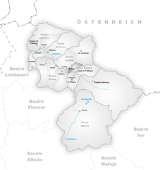
Контерс (Conters im Prättigau, Conters im Prättigau)

 Hiking in Контерс
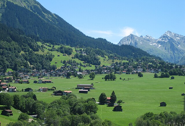
Conters im Prättigau is a charming village located in the Graubünden region of Switzerland, surrounded by stunning natural landscapes and offering various hiking opportunities. Here are some key points to consider when planning your hiking adventure in and around Conters:
Trails and Scenery
-
Variety of Routes: The area offers various hiking trails suitable for different skill levels, from easy walks to more challenging hikes. The trails allow you to explore beautiful meadows, forests, and panoramic views of the Alps.
-
Nature Highlights: Hikers can enjoy the diverse flora and fauna, lush green landscapes in the warmer months, and picturesque mountain views. The region is known for its tranquility and is an excellent spot for those looking to connect with nature.
-
Local Attractions: Besides hiking, you can also explore local landmarks such as traditional Swiss architecture and historical sites in the surrounding villages.
Recommendations
-
Trail Maps: It’s highly recommended to carry a proper trail map or use a reliable hiking app to navigate the routes. Signposts along the trails are usually well-marked, but having a backup is always a good idea.
-
Equipment: Ensure you have appropriate hiking gear, including sturdy footwear, weather-appropriate clothing, and enough water and snacks for the hike.
-
Seasonal Considerations: Depending on the time of year, some trails may be closed due to snow, especially in early spring or late autumn. Always check the local conditions before heading out.
-
Guided Hikes: If you’re unfamiliar with the area, consider joining a guided hiking group. Local guides often provide insights into the region's natural history, culture, and hidden gems.
Accessibility
Conters is accessible by public transport, and there are local transport options to get to trailheads. The village itself is small and welcoming, making it a great starting point for your hikes.
Safety
Always inform someone about your hiking plans, especially if you’re venturing out on your own. Be mindful of weather changes and adjust your plans accordingly.
Whether you are a seasoned hiker or someone looking for a leisurely stroll, Conters im Prättigau has something to offer everyone. Enjoy your hike!
- Страна:

- Почтовый код: 7241
- Телефонный код: 081
- Код автомобильного номера: GR
- Координаты: 46° 53' 59" N, 9° 47' 0" E


- GPS треки (wikiloc): [Ссылка]
- Высота над уровнем моря: 1110 м m
- Площадь: 18.40 кв.км
- Население: 225
- Веб сайт: http://www.conters.ch
- Википедия русская: wiki(ru)
- Википедия английская: wiki(en)
- Википедия национальная: wiki(de)
- Хранилище Wikidata: Wikidata: Q65100
- Катеория в википедии: [Ссылка]
- код Freebase: [/m/026dz08]
- код GeoNames: Альт: [2661130]
- код VIAF: Альт: [240557657]
- ID отношения в OpenStreetMap: [1684065]
- идентификатор HDS: [1576]
- код швейцарского муниципалитета: [3881]
Граничит с регионами:


Ароза
Hiking in Ароза
Arosa is a beautiful alpine resort located in Switzerland, renowned for its stunning landscapes, diverse trails, and welcoming atmosphere for hikers of all skill levels. Here’s an overview of hiking in Arosa:...
- Страна:
- Почтовый код: 7050
- Телефонный код: 081
- Код автомобильного номера: GR
- Координаты: 46° 46' 0" N, 9° 40' 1" E
- GPS треки (wikiloc): [Ссылка]
- Высота над уровнем моря: 2003 м m
- Площадь: 42.53 кв.км
- Население: 3185
- Веб сайт: [Ссылка]

Кюблис
Hiking in Кюблис
Küblis, located in the Prättigau region of Switzerland, is a lovely spot for hiking enthusiasts. Nestled between the mountains and close to the Landquart River, this area offers a variety of trails that cater to different skill levels, from easy walks to more challenging hikes....
- Страна:
- Почтовый код: 7240
- Телефонный код: 081
- Код автомобильного номера: GR
- Координаты: 46° 54' 53" N, 9° 46' 27" E
- GPS треки (wikiloc): [Ссылка]
- Высота над уровнем моря: 814 м m
- Площадь: 8.14 кв.км
- Население: 853
- Веб сайт: [Ссылка]


Фидерис
Hiking in Фидерис
Fideris is a picturesque village located in the canton of Graubünden in Switzerland. It's a great base for hiking enthusiasts due to its diverse trails and stunning alpine scenery. Here’s what you need to know about hiking in and around Fideris:...
- Страна:
- Почтовый код: 7235
- Телефонный код: 081
- Код автомобильного номера: GR
- Координаты: 46° 53' 12" N, 9° 44' 22" E
- GPS треки (wikiloc): [Ссылка]
- Высота над уровнем моря: 1653 м m
- Площадь: 25.36 кв.км
- Население: 598
- Веб сайт: [Ссылка]


Зас
Hiking in Зас
Saas im Prättigau is a fantastic destination for hiking enthusiasts, nestled in the stunning Prättigau region of the Swiss Alps. Here are some key points to consider about hiking in this area:...
- Страна:
- Почтовый код: 7247
- Телефонный код: 081
- Код автомобильного номера: GR
- Координаты: 46° 54' 59" N, 9° 47' 59" E
- GPS треки (wikiloc): [Ссылка]
- Высота над уровнем моря: 988 м m
- Площадь: 26.71 кв.км
- Веб сайт: [Ссылка]


Луцайн
Hiking in Луцайн
Luzein is a picturesque Swiss village located in the canton of Graubünden, surrounded by stunning alpine landscapes. It’s a great destination for hiking enthusiasts, offering a diverse range of trails that cater to different skill levels. Here are some details about hiking in Luzein:...
- Страна:
- Почтовый код: 7242
- Телефонный код: 081
- Код автомобильного номера: GR
- Координаты: 46° 55' 11" N, 9° 46' 0" E
- GPS треки (wikiloc): [Ссылка]
- Высота над уровнем моря: 1892 м m
- Площадь: 31.60 кв.км
- Население: 1573
- Веб сайт: [Ссылка]
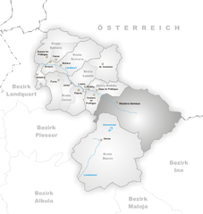
Клостерс-Зернойс
Hiking in Клостерс-Зернойс
Klosters, located in the Swiss Alps near the popular ski resort of Davos, is a beautiful destination for hiking enthusiasts. Here’s an overview of what you can expect while hiking in this wonderful area:...
- Страна:
- Почтовый код: 7250
- Телефонный код: 081
- Код автомобильного номера: GR
- Координаты: 46° 53' 0" N, 9° 53' 0" E
- GPS треки (wikiloc): [Ссылка]
- Высота над уровнем моря: 1342 м m
- Площадь: 193.10 кв.км
- Население: 4437
- Веб сайт: [Ссылка]